Utilize planning areas and distinct management areas
Breaking up your landscape to reach your planning goals
Previously, we’ve explored how you can use Vibrant Planet to:
- Assess and segment an analysis area by similar landscape features
- Identify features with societal values (SARAs)
- Understand how SARAs might respond to disturbances (response functions)
Evaluate your landscape based on your priorities
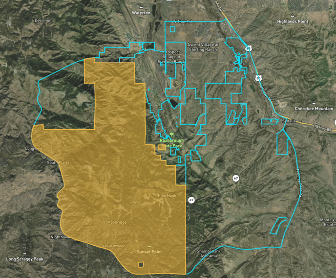
The next step is to consider your planning goals and objectives. Whether you’re focused on crossboundary planning, specific management areas that need unique management, or have a predetermined area you’d like to focus on within the landscape, Vibrant Planet helps you analyze at any scale based on your priorities. The total geographic area under consideration for land treatments is called a planning area.
Some subregions of your planning area may need to be treated differently – for instance, you may want to consider using Distinct Management Areas (DiMAs) within your landscape to:
- Isolate land ownership
- Isolate certain management emphasis areas (such as community protection zones)
- Emphasize different management objectives between DiMAs (such as Assets and Safety or Water)
- Restrict management options (remove specific treatment opportunities)
- Restrict certain areas from Planning (remove DiMAs from the planning process completely)

Other examples of DiMAs could include:
-
- Existing project boundaries for subsequent treatment sequencing, layout and contract preparation
- Threatened, endangered and/or sensitive species protected activity centers/habitat (e.g., spotted owl, northern goshawk, sage grouse habitat, etc.)
- Special land use designations (e.g., inventoried roadless areas, recreation areas, open space, etc.)
In the next section we will explore how Vibrant Planet considers wildfire hazard and SARAs to determine risk.
.png?width=800&height=147&name=VP_Logo_Horiz_Color_RGB%20(4).png)